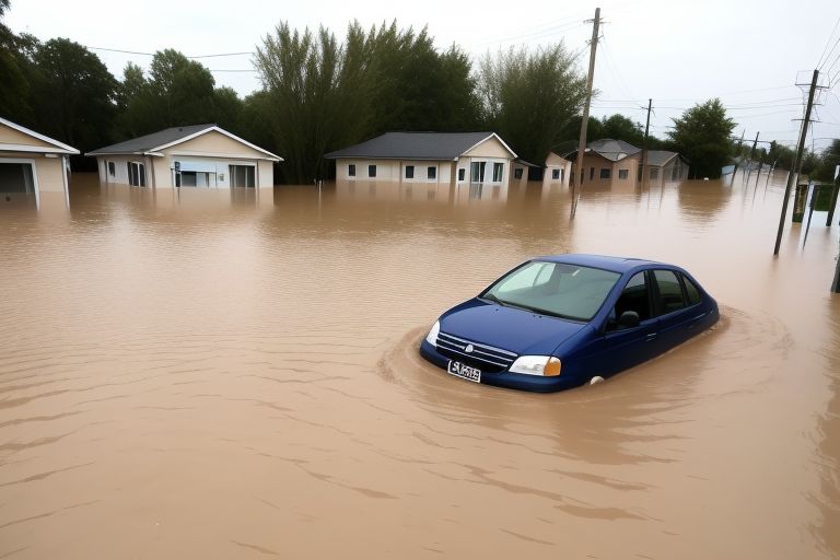
There was little warning of the floods that killed twenty people in Waverly, Tennessee, and the surrounding area.
Two to three inches of rain were forecast by meteorologists. However, during that August day in 2021, 21 inches of rain fell, sweeping away people, cars, businesses, pets, and even twins who were 7 months old.
They were utterly unprepared. They were therefore unable to alert people. According to Puja Das, a fourth-year Ph.D. candidate in interdisciplinary engineering at Northeastern University’s Sustainability and Data Sciences Lab, entire neighbourhoods were washed away.
With the aid of physics-guided generative AI, Das is currently collaborating with river managers and forecasters to investigate a more accurate method of anticipating destructive rainstorms.
Recently, she and two colleagues from Northeastern University travelled to flood-prone Tennessee as part of her research, which is supported by a NASA grant. There, they visited dams and had meetings with representatives from the Tennessee Valley Authority.
The TVA, which is the biggest public power company in the nation, is also in charge of overseeing the fifth-largest river system in the country.
Additionally, Das notes, they had meetings with the River Forecast Centre in Knoxville regarding their models and their decision-making process regarding which forecasts to use for a given extreme event.
They inquired about their needs from them. They claimed that because of the shortcomings in their current High Resolution Rapid Refresh (HRRR) model, they require forecasts of higher quality. According to her, they are seeking more accurate forecasts for managing rivers and floods, as well as dam operations.
A broken forecasting model
Less than a decade ago, in 2014, NOAA introduced HRRR, a physics-based model updated hourly.
However, meteorologists and government officials doubt its ability to cope with extreme weather events, which climate scientists and NASA claim are becoming more intense and frequent.
According to Auroop Ganguly, principal investigator at the SDS Lab and a distinguished professor of civil and environmental engineering at Northeastern University, even though HRRR incorporates the best physics available to date, it frequently provided false guidance and was unable to forecast significant precipitation events that result in flash and other dangerous floods.
According to Ganguly, who is also the director of Northeastern University’s Institute for Experiential AI’s AI4CaS (AI for Climate and Sustainability) focus area, it created a delusion of complacency.
Das cites the near-occurrence of the Waverly flood on August 21, 2021, as an illustration.
Rain was falling at a pace of three inches per hour by 7:30 a.m. However, their model was supplying them.25 inches per hour. Thus, she claims, they had no concerns at all. But it continued to mount.
The startling rate at which flood waters rose is demonstrated in footage from the flood that news stations like WSMV 4 Nashville broadcast.
According to Ganguly, the Tennessee River Valley’s topography—which spans seven states—puts it at risk for both flash flooding and dam overflow.
Can AI help?
Scientists claim that recent devastating and fatal floods, such as those that struck Germany and Pakistan, were caused in part by climate change.
There is a pressing need to develop new prediction models due to the increasing frequency and intensity of extreme rain events. According to Ganguly, the TVA no longer uses HRRR as an operational tool and now only uses it as a point of reference.
Presenting at a NASA PI meeting in Huntsville, Alabama earlier this year, Das’ research project, Remote-sensing data driven Artificial Intelligence for precipitation-Nowcasting (RAIN), is investigating the use of hybrid models incorporating traditional physics and hydrometeorology with information provided by radar and synthetic data generated by AI.
Along with this, she intends to assess how AI and machine learning can be used to create weather prediction models using data from satellites in partnership with Kate Duffy and Thomas Vandal, who both received their PhDs from Northeastern and worked for NASA before founding Zeus AI, a weather forecasting startup funded by NASA SBIR.
According to August Posch, a data scientist at Northeastern’s Seattle campus who is also collaborating with Das on satellite data, existing deep learning models like DGMR from Google’s DeepMind and NowcastNet from Tsinghua and Berkeley claim to outperform traditional physics-based models for some tasks.
Now, with very short-term precipitation forecasting, he wants to know (what happens) if they try to apply those cutting-edge models specifically for the Tennessee Valley problem, says Posch.
What are their advantages and disadvantages? He queries.
“In this specific context of a Tennessee Valley dam that needs to be opened and closed when extreme precipitation happens, and then developing metrics that are relevant to the TVA—metrics that might not exist yet, Posch says,” the RAIN research will assess a number of machine learning models.
Together with Posch and fellow PhD candidate Ashis Kumar Pal, who is conducting research on the effects of flooding on urban metro systems, Das travelled to Tennessee in late September.
Ganguly participated in a number of the talks because he sees this project guiding a significant research path at AI4CaS.
She claims that learning about the Norris and Douglas dams’ control centres and sluice gates firsthand gave her important knowledge about how long it takes to open the spillways and carry out other flood prevention measures.
According to Das, the purpose of the RAIN research is to give forecasters and dam operators useful tools. They are hoping it will enable them to produce more accurate forecasts.


